Research projects
Collecting, evaluating and using evidence allows us to make more informed decisions about bushfire management, and continuously improve our management of bushfire risk.
As part of the Safer Together program, the following research projects are currently underway.
Fire science
We are world-leaders in fire science. Our fire analysis and modelling is sophisticated and continually strengthened by fire scientists who are leaders in their fields. Through research partnerships, we are continually improving our understanding of how fires start, spread and behave.
Project: Climate change and fire weather
Fire managers need access to locally-relevant projections of future climate changes, as well as access to more granular interpreted changes to fire weather variables, to increase their understanding of the implications for local fire weather conditions and to provide guidance on the capital and operational resources that may be needed to facilitate the implementation of policies and measures. This project takes the projections of twelve Global Climate Models and applies a statistical downscaling method to produce a dataset and climatology for the period 1970 to 2100. The outcomes of this project will support better decisions across land and fire management by providing fire managers with a science-based resource for research, planning and preparedness under different climate change scenarios.
Project: Risk 2.0
Risk 2.0 will build on significant progress in bushfire research to strengthen our understanding of bushfire risk. This project focuses on four key areas: 1) We use fire simulations to support decision making in strategic planning, fire response and engagement activities. Risk 2.0 will improve the datasets and models used for these simulations. 2) We use the Estimated Risk metric to understand and report on the effectiveness of fuel management on public land to reduce bushfire risk to life and property. 3) We will extend our state-wide risk modelling approach to assess risk to other values beyond human life and property. 4) We will set the foundations and provide recommendations for future improvements of our bushfire risk modelling capability, such as consideration of climate change and inclusion of additional management levers
Project: Using empirical biodiversity monitoring data
This project is working with Melbourne University to develop codes and queries to produce species response curves using empirically derived data housed in the South West biodiversity monitoring database. The information will be displayed in a web interface for use by CFA, PV, and DELWP staff to inform ecological risk decision making in the South West; the database and web interface tool will be available for use by Traditional Owner groups, the scientific community and other interested users upon request. The curves will be derived from species presence and absence records and include the capability to explore interactions with fire variables, habitat structure and other environmental variables using network analyses. The database currently has sufficient data to develop response curves for 40 bird species, 12 ground-dwelling mammals and 112 vascular plant species. Both the SW Database and Empirical Data project will have built-in capability for data to be continuously added and integrated into response curves by agency staff, without the need for technical expertise.
Project: Effects of fire regimes in Victoria’s Big Desert – Wyperfeld parks complex
The habitat and fauna data that has come out of this project will be combined with historical data and data from future surveys to develop vegetation and fauna fire response models over the next 5 years. These models will be used to refine the current bushfire management strategy for the fire-dependent ecosystems in Big Desert. This knowledge is critical for evidence-based adaptive management to ensure that both fuel management and bushfire suppression activities promote resilient and viable ecosystems long-term.
Project: Cropland fire behaviour 2.0
Crop fires cause significant losses on an annual basis, yet the spread of crop fire is not clearly understood and fire modelling tools available may not be accurate in predicting crop fire behaviour. Through carrying out experimental burns, this project will develop a baseline for measuring fire spread on cropland. It will consider a variety of factors, including crop type and whether croplands are harvested or unharvested. Understanding of crop fire behaviour will help us mitigate the risks by more effectively allocating fire suppression resources and providing better information to the farming community.
Project: Better smoke management
In recognition of the impact that smoke can have on community health and industry, Safer Together has funded two smoke management projects: 'Better Smoke Management' and 'Smoke Taint'. The objective of Better Smoke Management is to deliver important improvements to Victoria’s smoke prediction and air quality information systems for bushfires as well as planned burns. This project will strengthen our tools, decision-making processes and understanding of the impacts of bushfire and planned burn smoke on health. Building on existing strong relationships with the Environmental Protection Authority (EPA), Bureau of Meteorology (BOM), Commonwealth Scientific and Industrial Research Organisation (CSIRO) , University of Tasmania and other researchers, Better Smoke Management will help us to continue integrating smoke and air quality information into decision-making processes. The research undertaken through this project will not only increase our knowledge of how air quality impacts from bushfires, planned burns and other sources can vary throughout the state, it will also improve our understanding of how these can impact the health of our communities. This project is supporting DELWP and CFA’s contribution to Victoria’s forthcoming Air Quality Strategy.
Project: Smoke taint
Smoke taint is focused on better managing the impacts of smoke taint in wine by developing an early warning system. The early warning system will inform planned burn decision making as well as alerting grape growers to the possible impacts of bushfires and planned burn smoke on crops before harvest.
Project: Relationship between soil and fuel drying – flammability switch
Many of Victoria’s major bushfires have occurred in ash and damper foothill forests, though most of the time these forests are too wet to sustain fires. When these landscapes transition from a wet to a drier state after prolonged periods of hot and dry weather, they can sustain large-scale severe fires, yet there is little scientific understanding of how much drying is needed for these forests to switch from a dormant state to a state that promotes freely spreading fire. This research aims to develop a model to help us predict the likelihood of a fire occurring and spreading in Victoria’s ash and damper foothill forest with a focus on factors that transition forest fuels into a flammable state. This will help us prepare and plan, as well as provide more accurate community information.
Project: User interface platform for the Victoria historical fire weather gridded dataset
This project will develop a user interface to facilitate access to historic fire weather gridded dataset by land and fire managers. While this dataset already exists, it is currently housed on a database with limited capacity to service a range of end-users. For this valuable data to be used by regional and district risk analysts from all agencies, a user-friendly data platform is required. The project will design and test the interface and develop online training for the wider user base.
Project: Creation of Grass Fire Danger Index dataset
The existing fire weather gridded dataset for Victoria comprises several weather variables and Forest Fire Danger Index (FFDI) outputs, however, it does not provide outputs for grass fire danger. This project will develop a historical Grass Fire Danger Index (GFDI) dataset to complement FFDI and to improve understanding of the entirety of the Fire Danger Rating system. To achieve this, a curing dataset will be derived from archived satellite data and combined with the Victorian historical fire weather data to produce the GFDI dataset. This will complete the fire weather gridded dataset to allow for analysis of historic bushfire risk.
Project: Development of seasonal fire prediction tools
It has been identified that the tools currently used for seasonal fire forecasting, Southern Australia Seasonal Bushfire Outlook, has limitations, including its inability to be readily updated and verified throughout the fire season and it does not meet fire agencies’ or community decision making needs. This project will review and clearly define the needs of fire agencies in Victoria to develop new seasonal fire forecasting products for risk purposes.
Project: Fuel accumulation monitoring and Phoenix analysis of mulched vegetation
Agencies across Victoria undertake a significant amount of non-burning fuel management to reduce the risk of Bushfire. While we measure this in terms of the number of hectares we deliver, this does not provide an understanding of the change in bushfire risk. This project is working with Melbourne University to understand how vegetation changes over time after mechanical treatment to better understand what the long term benefits of these works are. This will improve the bushfire prediction tool PHOENIX Rapidfire by including mechanical fuel treatments in PHOENIX Rapidfire to better enable our understanding of bushfire risk at the statewide and local scales.
Effective Operations
Monitoring the impact and effectiveness of our fire management operations is crucial for ensuring we are managing bushfire risk in the best possible way.
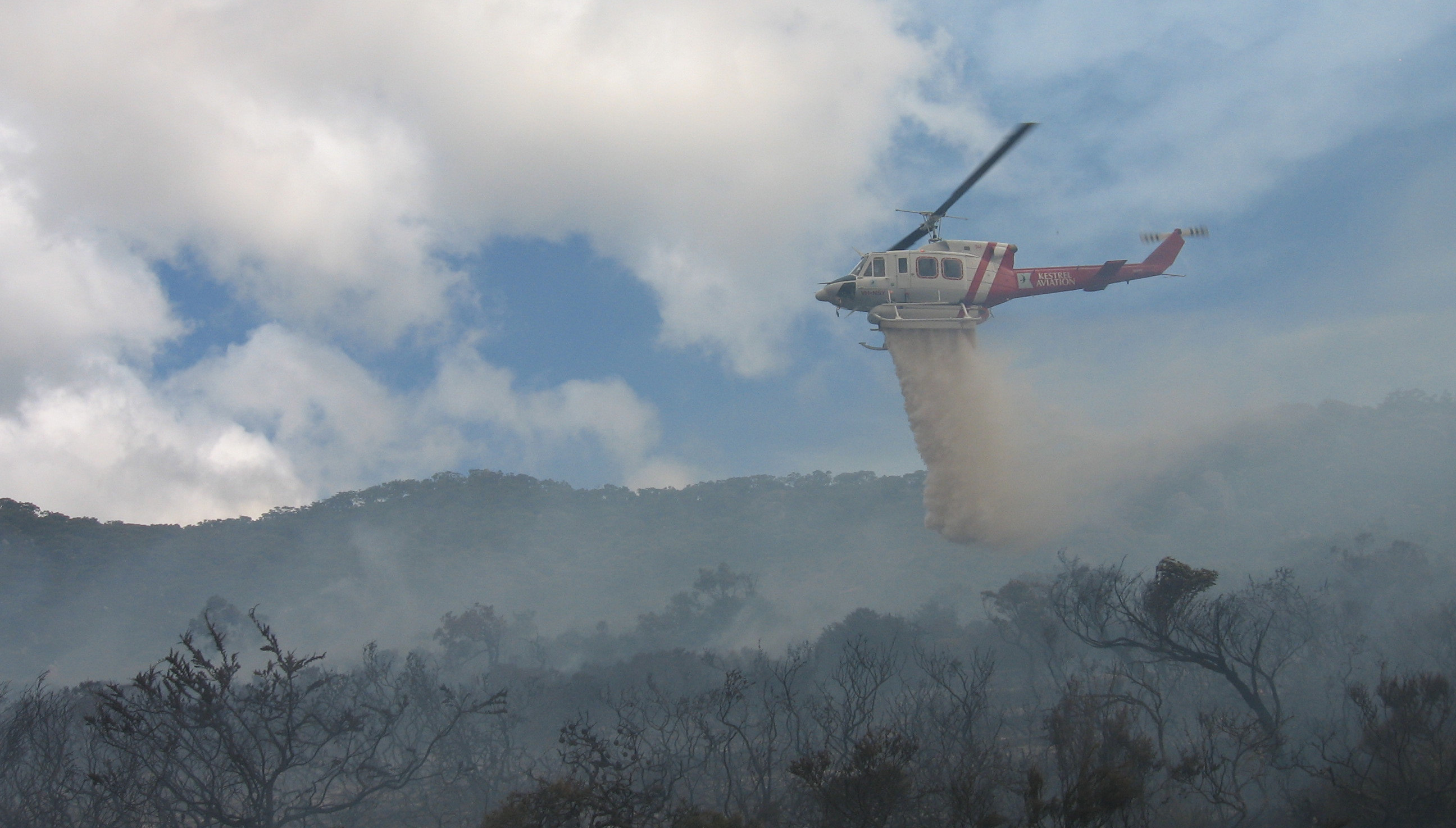
Project: Effectiveness of resources to suppress bushfire: aerial and ground-based
While there have been many studies on productivity rates of hand crews, bulldozers and aircraft, which have demonstrated high variability in the line production rates, little research has been conducted into the production rate of ground-based tankers. This project will determine resource use and productivity at real incidents, with the availability of tracking devices on both ground-based and aerial resources. This data will assist in making better decisions in fire suppression situations to maximise the effectiveness of efforts and provide an evidence base for economic justifications relating to firefighting fleet and resources.
Project: Identify barriers to implementing research knowledge into practice
The project purpose is to investigate barriers and enablers to implementing relevant research outcomes experienced in an organisation’s work, this aims to develop its research utilisation capability as measured by the AFAC Research Utilisation Maturity Matrix (RUMM) and other indicators developed from an investigation of the organisation’s work culture. It focuses on the critical question of barriers to the use and application of knowledge to improve the ways we work.
Understanding our Environments
Victorian ecosystems are diverse and complex. Research into biodiversity, fire ecology and ecosystem resilience all contribute to ensuring we have the most up-to-date information to most effectively manage for healthy environments.
Project: Fire and biodiversity - impacts, recovery and future planning: vegetation responses to planned fire
We know that appropriate fire regimes are an important part of how our diverse environments survive. This research project will address knowledge gaps relating to the relationships between fire and sensitive environments. It will improve our understanding of vegetation responses to planned fire, of fauna responses in fire-prone environments and the vulnerability of fire-sensitive environments to bushfire. These insights will reduce the uncertainty of the impacts of bushfire and planned burning on biodiversity and ecosystem resilience, improve the application of planned fire to both enhance fire-dependent ecosystems and habitats and to reduce bushfire risk to fire-sensitive ecosystems and improve our understanding of appropriate post-fire recovery interventions. They will improve land and fire management and community understanding and confidence in bushfire management planning, delivery and recovery.
Project: Fire ecology strategy for Wilson’s Promontory National Park
Wilson’s Promontory National Park is home to many threatened plant and animal species, such as the New Holland Mouse and Thick-lipped Spider Orchid. Managing fire in this region is complex because some these threatened species habitats are sensitive to fire, while others require fire to maintain certain ecological processes. Because of these differing responses to fire, there are significant challenges around reducing fuels and protecting key assets, as well as maintaining/restoring wildlife habitat. The objective of the Fire Ecology Strategy is to repair and sustain ecological processes in coastal woodlands and heathland in Wilsons Promontory National Park. Fire applied to ecosystems with a science-based method is an essential tool to achieve this objective. The outcomes from this strategy will direct ecological burning, identifying where and when to apply fire for the long-term sustainability of threatened plant and animal species. The project will also document the methodology used to produce the Strategy to describe a potential delivery process/template for fire ecology planning in other locations in the future.
What do fire experts say?
Associate Professor Kevin Tolhurst of the School of Ecosystem and Forest Sciences from the University of Melbourne, discusses technology and innovation in fire sciences at Science In Use at the DELWP Science Symposium 2015
Dr Steve Leonard, Research Fellow with the Department of Ecology, Environment and Evolution, La Trobe University discusses ecological responses to fire and monitoring, evaluation and reporting at Science In Use, the DELWP Science Symposium 2015
Prof. Kathryn Williams, of the School of Ecosystem and Forest Sciences from the University of Melbourne discusses the science of community values at Science In Use, the DELWP Science Symposium 2015
Understanding smoke
DELWP and the Environment Protection Agency (EPA) are working with universities and research organisations to improve forecasting of smoke behaviour – where it will go and how intense it will be – and understanding its impact on communities.
Predicting the spread, accumulation and dissipation of smoke from planned burns and bushfires
By improving our understanding of fuel emissions, fire behaviour, weather and climate processes, this research is improving our understanding of how smoke from planned burns and bushfires, spreads, accumulates and dissipates. The project will provide training and tools to help fire management agencies to better understand smoke and its impact on communities and industries.
Bushfires, Smoke, and People - assessing the risks and benefits from planned burning on the urban-rural interface
This research, being undertaken by University of Tasmania and the Menzies Institute for Medical Research is
- Working with fire management agencies to develop scientifically-informed practical guidelines for managing smoke from planned burns and bushfires
- Using air quality monitoring, satellite imagery and atmospheric modelling tools, to learn how different fire management practices affect community exposure to smoke.
- Developing practical public health approaches for managing smoke exposure impacts.
- Using meteorological Doppler radar to measure and track the spread of smoke plumes from planned burns and bushfires
The results of this work will contribute to better outcomes in the community aimed at reducing the impact of smoke from bushfires and planned burns.
Phoenix Rapid Fire case study
Phoenix RapidFire is a sophisticated bushfire simulation tool used to model bushfire risk. Developed by the Department of Environment, Land, Water and Planning (DELWP), the University of Melbourne and the Bushfire and Natural Hazards Cooperative Research Centre, Phoenix uses information about weather, topography, vegetation and fire history to simulate (and predict) the spread and impact of bushfires. It helps us to understand bushfire behaviour – including flame height, ember density, spotting distance, convection column strength and intensity.
DELWP, Parks Victoria and the CFA use Phoenix to understand how different fuel management activities affect the amount and location of bushfire risk across landscapes. This helps us to identify the most effective strategies to reduce bushfire risk.
Phoenix is also used to support bushfire response, informing the preparation and positioning of fire fighters, aircraft and equipment on days of high fire danger. Phoenix bushfire simulations are also used to help communities understand how bushfires behave. Maps and simulations are used in conversations with communities about what bushfire risk means for them.
Monitoring, evaluation and reporting
Our framework for monitoring, evaluation and reporting is used to better manage outcomes as well as activities. Information from monitoring is embedded in our future decisions and becomes part of our knowledge and capability for better bushfire management.
This forms a foundation for activity across the fire management sector; a foundation of shared knowledge and evidence on which we can improve our ability to reduce bushfire risk.
We are building on this foundation through sector-wide monitoring, evaluation and reporting framework that incorporates knowledge and experience of all agencies and local communities.
Safer Together Monitoring, Evaluation and Reporting framework (pdf)
Safer Together Monitoring, Evaluation and Reporting framework (accessible version)
Fuel Management Report
This report is the summary of Forest Fire Management’s annual fuel management activities and achievements towards reducing Victoria’s bushfire risk. It presents metrics and measures for assessing the performance of the fuel management program at the State and regional levels, including fuel management activities, costs and monitoring, evaluation and reporting outcomes. Case studies about our engagement and collaboration with communities in each region demonstrate our commitment to the meaningful involvement of local communities in our activities.
Visit the Forest Fire Management website for recent Fuel Management Reports.
Fuel Management Report 2014-15 [PDF File - 3.1 MB]
Fuel Management Report 2014-15 [MS Word Document - 366.4 KB]
Focusing on community values
People value many different things in a region. Homes and properties, infrastructure and our unique ecosystems are all factored into our bushfire management planning. However, people also have very personal connections to their landscapes and their environments that stem from their sense of place and why they enjoy living in the bush.
We are investing in several projects to try and better understand how people connect with their surroundings and what they value in a landscape. This work will help us identify some of the less tangible things people care about and how we can most efficiently work to protect these values.
Evaluating our effectiveness
Monitoring operational effectiveness is critical for ensuring we are managing bushfire risk in the best way possible. We use key questions to assess how effective our actions are at reducing the risk of major bushfire and how we have changed vegetation levels and key habitats for vulnerable species.
You can find out more about our monitoring, evaluation and reporting here
Research Partners
We partner with a range of independent research organisations who are experts in their fields and who promote best practice in multiple aspects of bushfire management
Page last updated: 23/08/24