We can better reduce these impacts by understanding where and how bushfires spread, how they impact communities and the environment, and measuring how effective our actions are in reducing these impacts.
What is bushfire risk?
Bushfire risk is the likelihood of a fire starting, spreading and impacting on people, property and the environment – the things we care about most.
Victoria is particularly susceptible to large, intense bushfires which can spread up to 30 km or more across landscapes. This is due to Victoria's terrain, naturally flammable vegetation and frequent exposure to hot, dry, windy weather.
Factors that affect bushfire risk include the type and condition of fuels, weather, topography, the location of people and assets, as well as our ability to prevent fires from igniting and suppress them once they have started.
Reducing the impacts of bushfires is challenging because we don't know exactly when and where they will occur. However, we can model how bushfires spread in the landscape with simulation software, Phoenix RapidFire, developed specifically for Victoria.
Phoenix RapidFire uses information about weather, topography, vegetation and fire history, to simulate and predict the spread and impact of bushfires and help us understand bushfire behaviour – including flame height, ember density, spotting distance, convection column strength and intensity.
Using these simulations, we can understand how bushfires are likely to behave, and how assets and values might be impacted by bushfires.
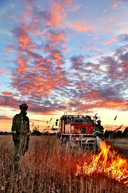
Copyright Paul Hitch
How we manage bushfire risk
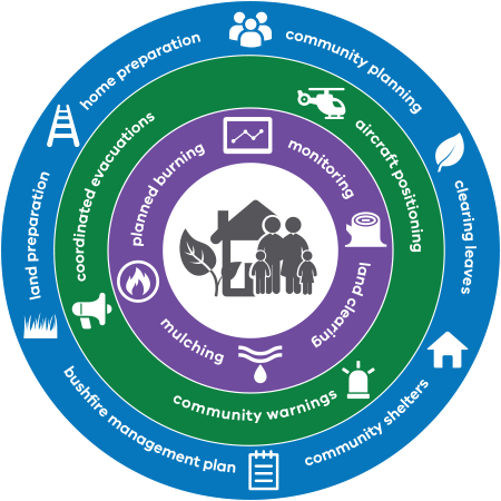
No single strategy or action alone can manage bushfire risk. We must develop a multifaceted approach, using all the activities available to us. Fuel management is just one strategy for reducing bushfire risk.
Planned burning is a key part of fuel management, but it also includes:
- slashing and mowing
- creating fuel breaks around towns and assets
- maintaining infrastructure like fire dams and lookout towers in our forests and parks
Beyond fuel management, our fire management activities include:
- preparing and positioning firefighters and aircraft across Victoria for rapid response to bushfires when they start
- building standards for new housing
- developing neighbourhood shelters
- issuing community warnings
- coordinating evacuations
Our land and fire agencies will work in partnership with local communities through these initiatives to best reduce risk in a particular region.
Fire and the environment
Victoria is one of the most fire-prone and fire-adapted regions in the world. Fire plays an important role in many of our ecosystems. But too frequent or too intense fires can have adverse impacts. We aim to balance the amount of fire in the landscape to promote the resilience of ecosystems and protect vulnerable habitats.
See our Healthy Environment page to find out more about how we consider the environment and the health of ecosystems in managing bushfire risk.
Safer Together approach
Safer Together is our approach to reducing the risks of bushfire in Victoria that combines stronger community partnerships with the latest science and technology to more effectively target our actions.
Our aim has always been to reduce risk from bushfires, with planned burning being only one of a range of tools available to reduce risk.
Our approach is about:
- better assessing where and when to use fuel management and other risk reduction activities
- avoiding unacceptable impacts on the community and the environment
- better integration across public and private land
- land and fire managers working together with communities to plan and deliver integrated bushfire management
- ensuring decision-making is centred on the views, strengths and values of the community
- using world-leading science to manage fire and ecosystems.
Page last updated: 20/03/25